





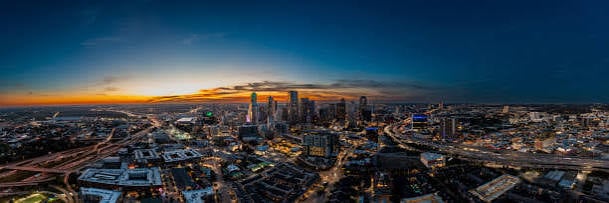
Aerial images can show how a site, venue, or surrounding area looks from above. For businesses considering aerial photography in Dallas, these images may support construction records, infrastructure reviews, event planning, and promotional materials. Their value depends on what you need to photograph and how you’ll use the results. Comparing practical applications helps companies decide when overhead views add useful information.
How Is Aerial Photography Used in Construction and Infrastructure?
Construction teams and infrastructure managers may use aerial photographs to document sites, review visible conditions, and share information with stakeholders.
- Progress Records: Repeated photos taken from the same positions show changes at different project stages.
- Site Overviews: Overhead images show building placement, access routes, storage areas, and surrounding work zones.
- Visual Inspections: Photos can help identify visible concerns on roofs, towers, or other difficult-to-access structures.
- Project Communication: Images give owners, contractors, and clients a common reference when discussing work completed.
Photographs can supplement site reports and inspections, but they don’t replace professional assessments or reveal the condition of hidden components.
Where Can Businesses Use Aerial Images for Marketing and Events?
Businesses also use overhead photography to show their surroundings, illustrate venue size, and create images for public communications.
- Hospitality Marketing: Hotels and restaurants can show outdoor spaces, adjacent streets, and the wider setting of their location.
- Event Planning: Organizers can document layouts, entrances, parking areas, and gathering spaces before or after events.
- Tourism Materials: Destination organizations can illustrate parks, cultural attractions, and neighborhoods from a broader perspective.
- Corporate Communications: Companies can use aerial images in reports, websites, and presentation materials to explain operations.
For each use, the intended audience, filming permissions, weather, and image format influence when and where photography should take place.
What Rules Apply to Commercial Drone Flights in Dallas?
The Federal Aviation Administration’s Part 107 rules generally govern commercial drone flights. Operators must meet applicable pilot certification, aircraft registration, and flight requirements. In controlled airspace, flights generally require FAA authorization before takeoff, which matters in parts of the Dallas area near airports. Flights over people or moving vehicles have additional restrictions. Businesses should discuss the proposed location, flight conditions, and permissions with the operator in advance.
How Can Businesses Plan an Aerial Photography Session?
Planning starts with the images’ purpose. A construction company may need repeated views from similar positions, while a hotel may want photographs of outdoor areas at a particular time of day. Businesses can share preferred angles, delivery dates, and required image formats before the flight. Site access, nearby airspace, and weather can also affect scheduling. Agreeing on these details in advance makes the final materials easier to use.
Conclusion
Commercial aerial photography has uses beyond property listings, particularly for visual project records, location marketing, and event documentation. Overhead images can complement ground photography by showing site layout and surrounding areas. Before commissioning work, businesses can identify the images they need, explain their intended use, and confirm that the operator can fly legally at the chosen location. This planning helps set expectations for the final images.